|
You have been given the job of designing a new city. It will be located at Warnervale on the Central Coast between the M1 and the Pacific Highway. The aim of your city design is to plan the most liveable city possible. Task 1: Brainstorm your ideas and begin planning. Create a list or mind map of all the features that your city will need. At this stage you are just coming up with ideas. You may change your mind as your city design develops.
Task 2: Design your city plan You have been provided with an outline map. Use your mapping rules to begin designing your city. Include border, orientation (north point), a legend, a map title and scale. On your map label the M1 motorway, Sparks Road and the railway line. Draw and label all the key features of your city.  Task 3: Draw your CBD and a residential area.
Construct sketches of how you imagine your city will look like. Annotate your images with important features of your city (style of building, tree-lined streets, community spaces, retail spaces, etc). Task 4: Create a prospectus Write a report that addresses how you have created a "liveable" city. Refer to the questions outlined in Task 1 to help you structure your response. Scan your city plan and CBD and residential area drawings and include them in your prospectus.
1 Comment
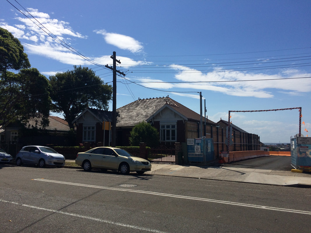
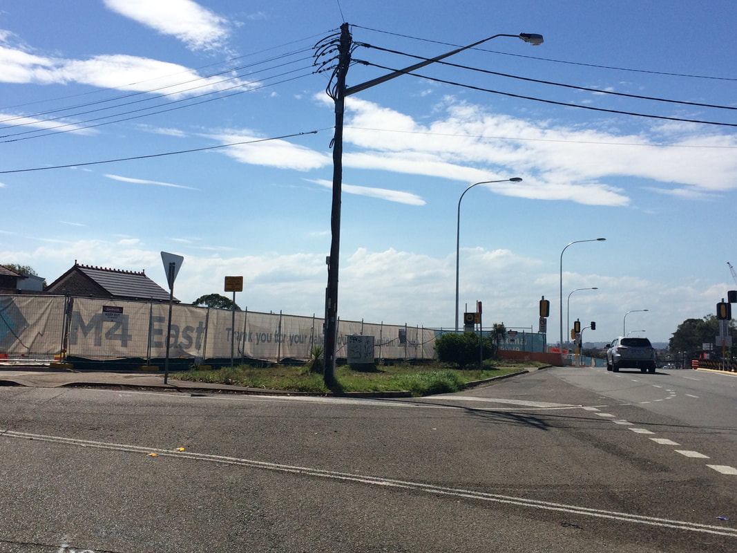
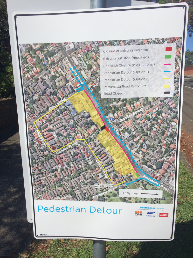
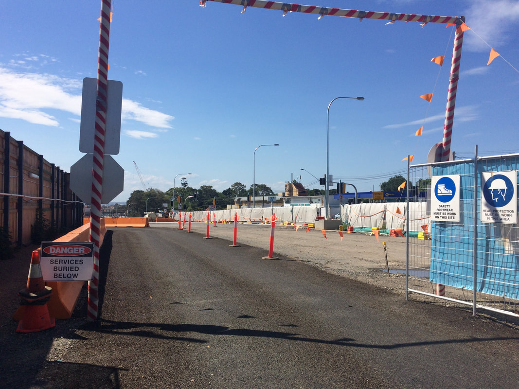
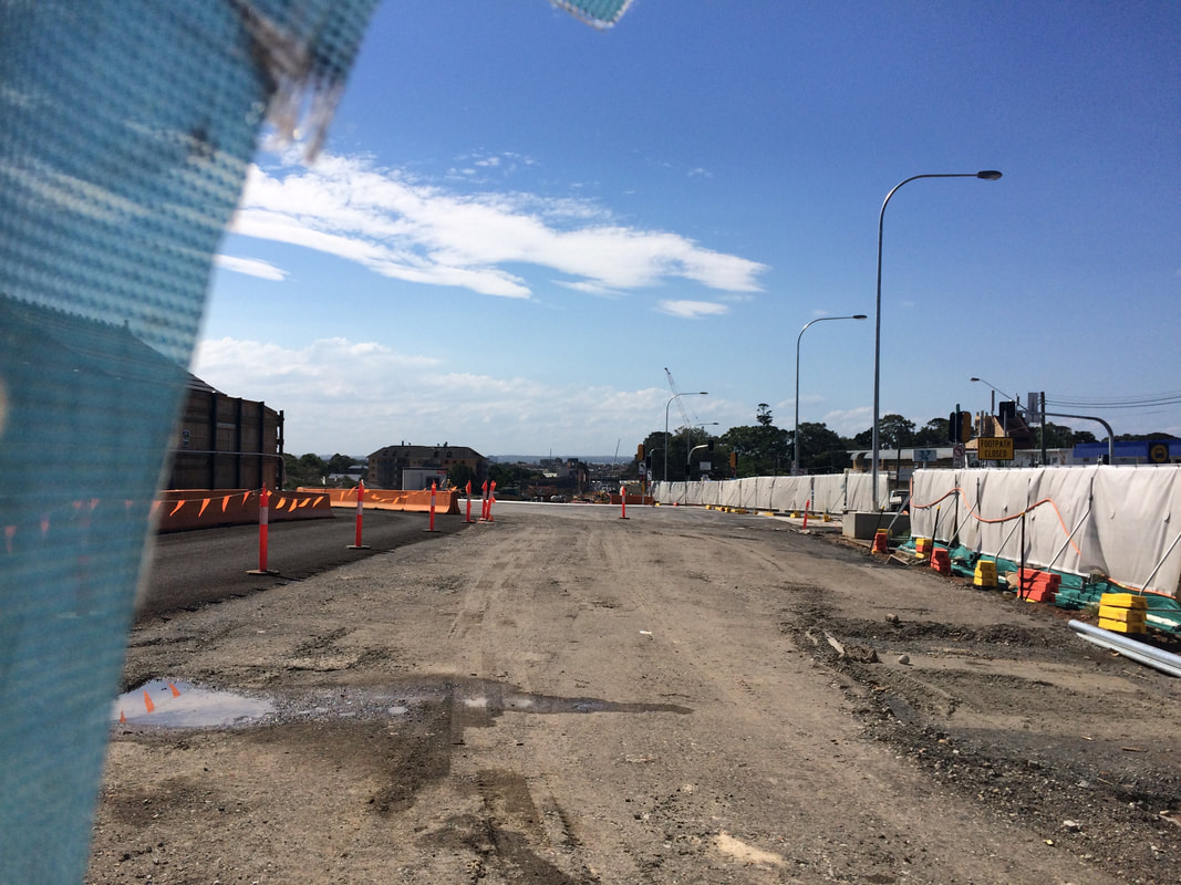
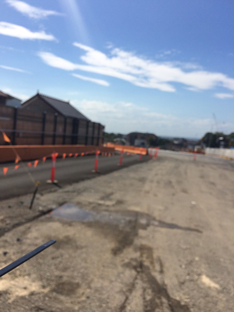
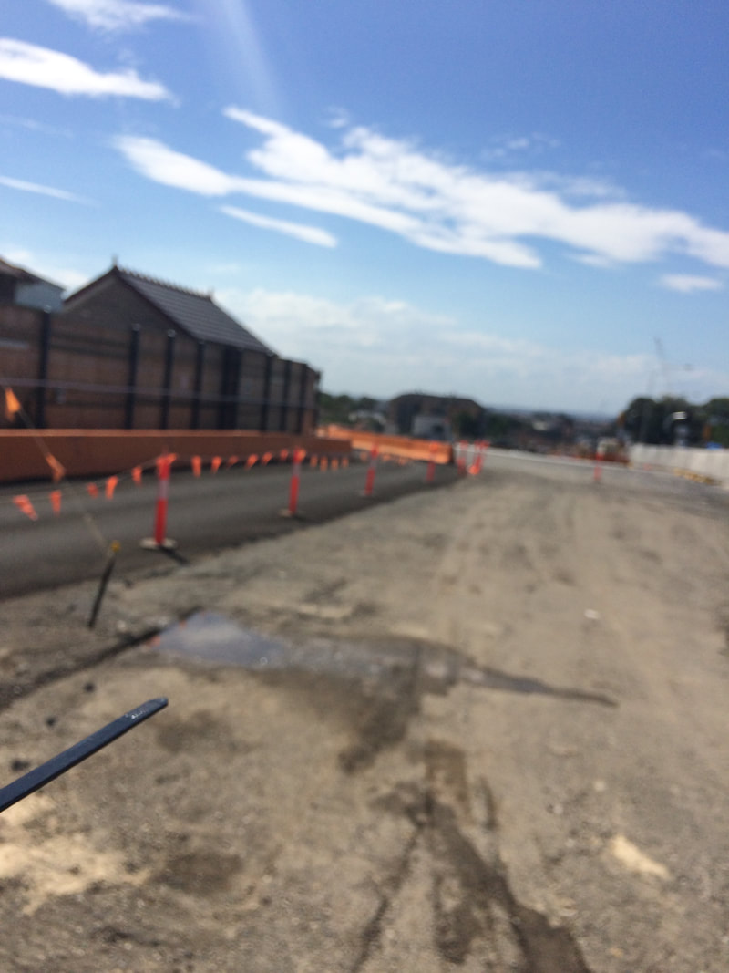
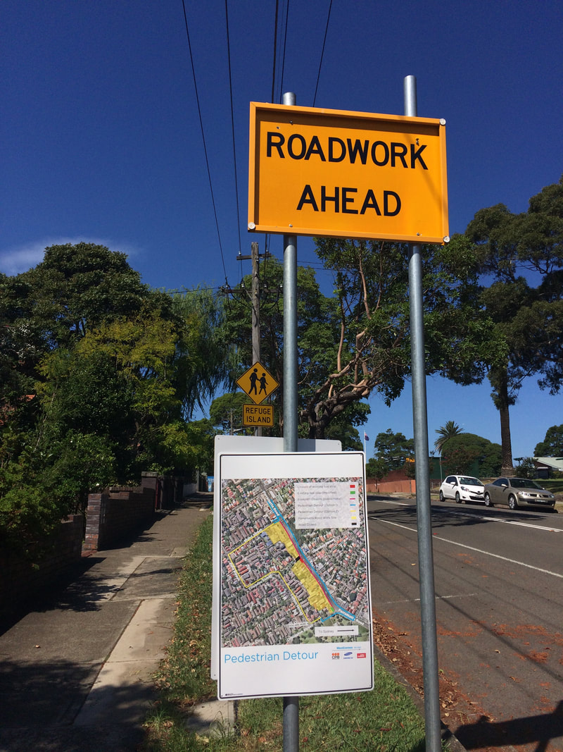
This is part of a unit of work for Changing Places - Australia's Urban Future. Lesson 1: Australia's Projected Population Growth Lesson 2: Implications for Future Growth and Sustainability Lesson 3: Sydenham to Bankstown Urban Renewal Precinct Lesson 4: WestConnex - Sydney, Sustainability and Transport Lesson 4: Sydney Sustainability and Transport (Teacher's Notes) Lesson 5: The GreenWay Lesson 5: Deindustrialisation Lesson 6: Create an infographic Lesson 7: Contributing to a Sustainable Urban Future Lesson 7: WestConnex - Protest Movements and Impacts Lesson 7: Conflict Over Dulwich Hill OR See the complete unit on the Changing Places website. Stage 1 of the WestConnex project involves the widening of the M4, a connection between Parramatta Road and the City West Link and new connections at Concord Road. A tunnel will run from the end of the current M4 to the City West Link, M4 East concept design WestConnex Stage 1 WestConnex interactive map Ashfield A section of Ashfield along Parramatta Road was acquired and demolished for WestConnex. The exit to the M4 tunnel will be opposite Bunnings Warehouse near the crossroads of Frederick St/ City West Link and Parramatta Road. Link: WestConnex plan jeered by Ashfield residents Save Ashfield Park Rally Haberfield Some of the issues raised in relation to WestConnex in Haberfield include home acquisitions, destruction of heritage architecture, noise and vibrations for homes adjacent to construction sites, changes to traffic flows and the impact of all of these factors on the nature of the suburb. Links: Haberfield homes acquired for building of WestConnex Three month closure of Ramsay Street Haberfield Talking WestConnex and Mike Baird ignoring compulsory aquisition reforms WestConnex private contractors sell items from heritage homes ahead of demolition WestConnex unused land should be handed back say inner west residents. Residents in Haberfield and Beverley Hills claim WestConnex work is cracking walls of houses near motorway construction sites. What we are facing is the destruction of Haberfield
This is part of a unit of work for Changing Places - Australia's Urban Future.
Lesson 1: Australia's Projected Population Growth Lesson 2: Implications for Future Growth and Sustainability Lesson 3: Sydenham to Bankstown Urban Renewal Precinct Lesson 4: WestConnex - Sydney, Sustainability and Transport Lesson 4: Sydney Sustainability and Transport (Teacher's Notes) Lesson 5: The GreenWay Lesson 5: Deindustrialisation Lesson 6: Create an infographic Lesson 7: Contributing to a Sustainable Urban Future Lesson 7: WestConnex - Protest Movements and Impacts Lesson 7: Conflict Over Dulwich Hill OR See the complete unit on the Changing Places website. Stage 5 Geography - Changing Places In the previous 7-10 syllabus in Environment Issues there was a section of content where students were asked to investigate individual, groups and government responses to an issue. In the new NSW syllabus this has been removed. However, in Stage 4 Changing Places the issue of WestConnex protests (or some other protests) can be used to address the inquiry questions:
Students can examine transport networks as both a cause and consequence of urbanisation (see previous post - WestConnex - Sydney, Sustainability and Transport) Students can also use it to examine the following content dot points:
Below: The St Peters West Connex site.
Stage 6 Geography - Urban Places/Urban Dynamics In a previous post I wrote about how WestConnex could be used as a way of exploring growth, development, future trends and ecological sustainability for a Sydney case study in the urban dynamics section of the HSC course. Another way this issue could be used in this course would be to use it to explore the culture of place of a suburb like Haberfield. There have been a variety of articles regarding the nature of the suburb in terms of heritage architecture, noise, and street life, and how this has and will change as a result of WestConnex. There are also a number of articles regarding the development site at St Peters and the removal of established trees on Sydney Park. This could also be used as a way to ask problematic questions such as: - What is the cost of development?, - What kind of Sydney do we really want? - Do the benefits to the city/commuters outweigh the costs to others? - Will the project really releive traffic in the long term? 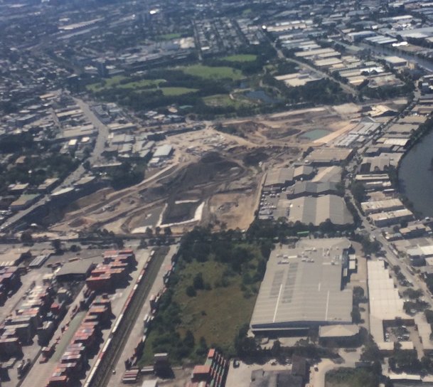
Students can do this through the lense of community protests to examine how different groups and individuals perceive how WestConnex (both a consequence of and a response to urbanisation - i.e a response to traffic congestion, the need for transport infrastructure) impacts their community and/or environment. In the previous syllabus there was a lot of scope to do activities such as mock council meetings, mock letters to Members of Parliament, etc. A simple search on Youtube brings up many recorded meetings regarding the project. This is an ideal scenario to use in class to reenact (or participate in) this process. While NESA/BOSTES has not completed a rewrite of the Civics and Citizenship Australian Curriculum, we can assume it will be relatively similar based on the rewrites of 7-10 History and Geography. In Civics and Citizenship (AC) students examine how citizens participate in direct action and lobbying (Year 8) and how and why individuals and groups participate in and contribute to civic life (Year 9). This provides a perfect example to explore these kinds issues and to build on student knowledge in Civics and Citizenship. Resources Below is a list of links to articles and websites related to WestConnex protests. You will notice that some of these are from media outlets such as Green Left Weekly and Alt Media. In a previous post on WestConnex most of the links I provided were government websites. The two posts together provide a more balanced approach to the issue and any lesson to students should include a range of perspectives and encouraging students to do their own analysis and make their own conclusions. WestConnex: Protesters clash with Police over 800 tree-deaths Protesting businesses in Newtown and Enmore stick it to WestConnex Haberfield homes acquired for building of WestConnex Three month closure of Ramsay Street Haberfield Talking WestConnex and Mike Baird ignoring compulsory aquisition reforms WestConnex private contractors sell items from heritage homes ahead of demolition Clover Moore supports protesters at 24-hour-a-day camping blockade... WestConnex protesters arrested as Sydney Park trees come down. Protesters Clash with WestConnex workers How the 15.4b WestConnex will affect Sydney residents Baird's new protest laws used against WestConnex protesters Protests grow over WestConnex Stop WestConnex WestConnex Action Group In 1989, Maxis (later purchased by Electronic Arts) released the first version of SimCity. In junior high school, playing computer games on my dad's computer, I was hooked. I think this is the game that turned me into a lifelong geographer and tech enthusiast. I loved designing cities, experimenting with the parameters of what would make a great city. Even early on I would try to add lots of parks and build the city around the appealing features of the natural environment like rivers, bushland, etc. I would be devastated if one of the natural disasters hit and wiped out parts of my city. As the game progressed over the years it really did get better and better. There were also variants of SimCity released such as SimFarm SimCopter and my favourite spin-off Sim Safari. Unlike a lot of games at the time of its original release (and I would argue even now) SimCity encouraged players to consider multiple interconnecting concepts and ideas, and plan strategically for a result with positive (if virtual) social outcomes. While many "shoot 'em up" games common now do involve strategic planning, for most of them the end result is killing something or someone. This game was a real stand out. Sim CitySim City is a computer game which allows you to build your own city. Sim City requires players to make decisions about both the built and physical environment, and consider the interplay between the different aspects. Through SimCity, players automatically begin to learn the metalanguage of urban planning and urban dynamics - using terms like residential zone, commercial zone, industry, transport infrastructure at the very basic level of the game. After repeated playing, the player begins to learn about the basic needs of a functioning city and its population, about how urban places grow and decline, human behaviour patterns and how even the best laid urban plans can go awry with an unexpected disaster. I will admit the Godzilla natural hazard does test the urban illusions - but it also adds a bit of humour. Natural hazards can be disabled. Lesson idea: Choose one of the following tasks, and outline the challenges that you faced in completing your task:
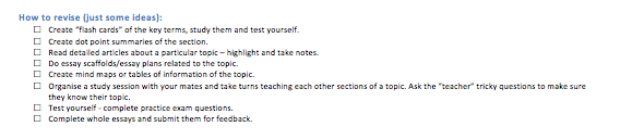
Following on from the Legal Studies revision planner is a Geography planner to guide student revision. For my class, I allocated Ecosystems At Risk and Urban Places two weeks each and only gave People and Economic Activity 1 week – this was because my class won't have done the the PEE case study by the time of the Trials. In this planner I have allocated 2 weeks revision for each topic and a week for skills revision. Depending on your students it is also a really good time to emphasise with students the importance of getting the balance right between study, their part-time job, socialising, eating right and exercising. If they can set up the right routines now, they will find it easier to cope when the Trials and HSC exams are on. 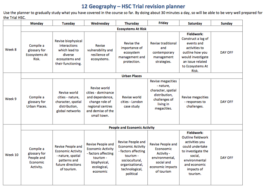 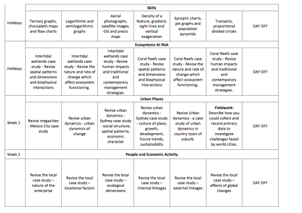
 Examine the Urban Observatory website.
Compare London, Tokyo and New York. Compare different aspects of these cities by choosing different themes from the left hand menu. Population Density and housing density: Describe the population and housing density of London. Where are the densest areas? Are particularly dense areas in a particular part of the city?How is the density spread out across the city - does it spread out radially? is it north/south, etc. How do these results compare with New York and Tokyo? How would you account for the differences? Work - Commercial and Industrial: Describe where the commercial areas of the city are located. Where are the industrial areas located? How does this compare to New York and Tokyo? Account for the differences. Movement - Road speed, traffic and airports: How would you compare the road speeds and traffic evident between the three cities? Why would this be the case? How would it impact on the way the city functions? What information can we gather about the importance of the airports in New York and London? Account for the difference in flight numbers between the two cities.
Your task is to create a presentation for your class which explains how one land use (residential, commercial or industrial) has changed over time. You must discuss each of the following: economic character, nature and location. Your presentation must include:
- statistics which support your key points - at least two maps (to show change over time) - an article which supports what you are stating You must prepare and distribute a two page handout. Your presentation should go for 8-10 minutes and should include a range of simulus (visual aids, etc). Articles: Paying huge Sydney prices for tiny places. Read more... What is sustainability? Sustainability is development which meets the needs of the present population without endangering the capacity of future generation to meet their needs. It incorporates three main principles: economic development, environment protection and social and cultural well-being. Each of these three principle is considered equally important, and act as a criteria to judge new development against. View sustainability infographic. Central Park, Ultimo Central Park is a development on the site of the old Kent Brewery at Ultimo. The development has been hailed as the next step in sustainable design. It has incorporated a grand-scale eco-design from its inception, includes vast areas of public space, is pedestrian friendly, and has retained some heritage elements. It has done all this while at the same time creating what will be a booming commercial and residential area in the heart of Australia's busiest city. Grand-scale Eco-design The design of several of the buildings incorporate huge vertical gardens designed by Patrick Blanc. Frames of growing plants are being constructed around the walls and roofs or the buildings. Eventually as they growing the gardens on the walls and roofs will grow into each other to cover the buildings. An issue associated with the creation of GRW is rhe need for water. It is important that they do not just create another burden on water. In Central Park they have installed a water recycling system to be used to water plants. Green roofs and walls - City of Sydney. Read more... Planting the town green. Read more... David Suzuki's vision for a sustainable city Parking spots make way for bus lanes. 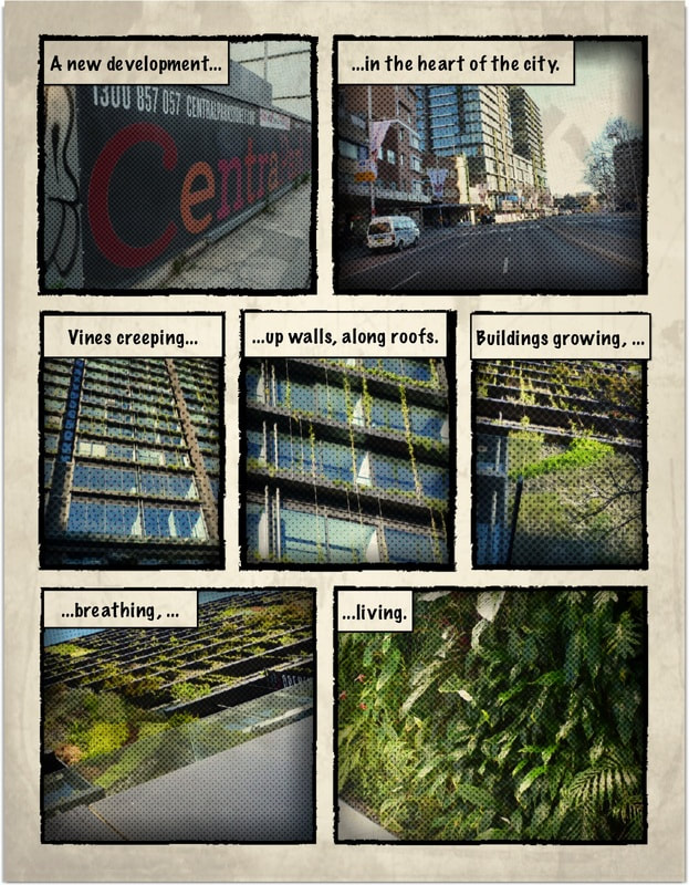 Noise
Suburbs located close to the city experience a range of noises. Traffic and construction noise are common, and noises associated with the high density of residential and commercial land use. The large number of pubs and clubs also create noise problems. Existing land uses can cause a problem for new resident in these highly sought after and expensive locations. For example residents in Milsons Point and McMahons Point made many complaints about the noise from rides at Luna Park. Properties close to the Harbour or Botany Bay may experience noise from naval vessels, container and passenger ships, recreational boating, and jet skis. This may affect La Perouse, Point Piper and Darling Point. Suburbs located close to the ocean would experience the sounds of the ocean. This includes Cronulla, Tamarama, Coogee and Bondi. Suburbs located underneath the flight paths from Sydney Airport are exposed to high levels of noise. This affects suburbs such as St Peters, Sydenham, Marrickville, Stanmore, Petersham, Leichhardt, Tempe, Mascot, Botany, Kurnell. Parts of suburbs located near major transport routes will also experience traffic, train and tram noise. Suburbs bordering industrial areas or ports may be impacted by noise from heavy machinery and transporting goods. This would impact suburbs such as Botany,Smithfield, Wetherill Park, Enfield and Chullora. Areas affected by the process of gentrification such as many suburbs in the inner west may be affected the noise from equipment for renovations such as sanders and grinders. Areas near large scale urban renewal projects would also be impacted by construction noise. People living in newly developed suburban areas with a high proportion of young families will be affected by noises such as children playing, barking dogs, leaf blowers, and lawn mowers. Areas with a high proportion of teenagers and young people may experience noise from revved-up cars, parties and loud car sound systems. Lifestyles The stereotypical Sydneysider spends a great deal of time on physical activity and sport and has a casual lifestyle. Sydney residents spend a fair proportion of their time in the outdoors, particularly in Summer In coastal areas this is coupled with a beach culture of hanging out on the sand or surfing. In some suburbs with strong multicultural influences, people are able to maintain cultural traditions from their country of birth, including food, language and customs. Street life
Street life in the city of Sydney is mainly determined by the commercial activity taking place. During the day the city is bustling with workers from nearby businesses and tourists enjoying the sites of the city. At night the pubs, clubs, theatres and restaurants encourage people to use the city to socialise and relax. In some suburbs the street life is influenced by the dominant ethnic community. In Kingsgrove, or Guildford, street life is influenced by the large Arabic population, who like to congregate in the front yard, porch or in the garage and socialise with those passing by. In Leichhardt, the Italian café culture encourages people to socialise in alfresco cafes. In newer residential areas with a young population street life is dominated by cars being washed, lawn mowed, bike riding, cricket games and children playing in parks. In other newer suburbs, the activity of children is contained within the house and street life is limited. Energy and vitality A concentration of events, people and facilities can be found in the inner city of Sydney and other smaller centres within Sydney such as Parramatta. These locations are hubs of activity, exchanges of ideas, and social activities and as such foster energy and vitality. Greater concentration of venues such as hotels and theatres are also likely to be found in these centres and are likely extend activities into the night. Suburbs with younger populations are found in the Blacktown, Liverpool and Campbelltown Local Government Areas and would tend to have more energy and vitality than those with older populations. The greying areas such as Pittwater, Hunter Hill and Kuringgai are likely to be quiet and subdued. Colour Coastal suburbs can be association with blue and yellow, representing the colours of the water and sand. Suburbs located near large national parks or areas of bushland could be seen as green suburbs. This would include St Ives, North Waroonga, North Epping. However the real green suburbs are those which have been designed to integrate environmentally friendly initiatives, for example Newington. Other green areas are those that have a high proportion of green voters, common in the inner west. Some older suburbs with heritage buildings use colours such as dark greens, maroons and blues. For example, Canterbury Council has strict regulations about the colour that homes can be painted in Ashbury. It uses a fairly strict colour palette to maintain uniformity in the suburb. Some suburbs can be associated with the colour pink due to their large gay and lesbian populations. These suburbs are also likely to be associated with a rainbow, the symbol for gay pride. These suburbs include Surry Hills, Kings Cross, Newtown and Leichhardt. Many newer suburbs in designed estates use fashionable colours such as stone and grey. As such the whole suburb is influenced by the colours preferred by the development company. Grey suburbs are those dominated by older age groups such as Bayview, Narrabeen and North Turramurra, reflecting the location of large retirement villages. |
|||||||||